Contact David F. Ryder III
Contacting David F. Ryder III
  • All fields are required.
Schedule A Showing
Schedule a Showing.
  • All fields are required.
Check this box to Register with us:
Request more information
Request More Information
  • All fields are required.
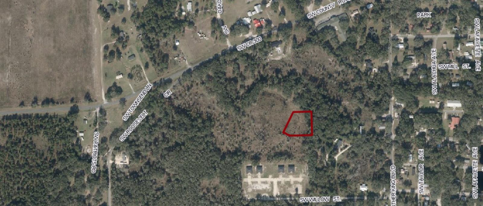
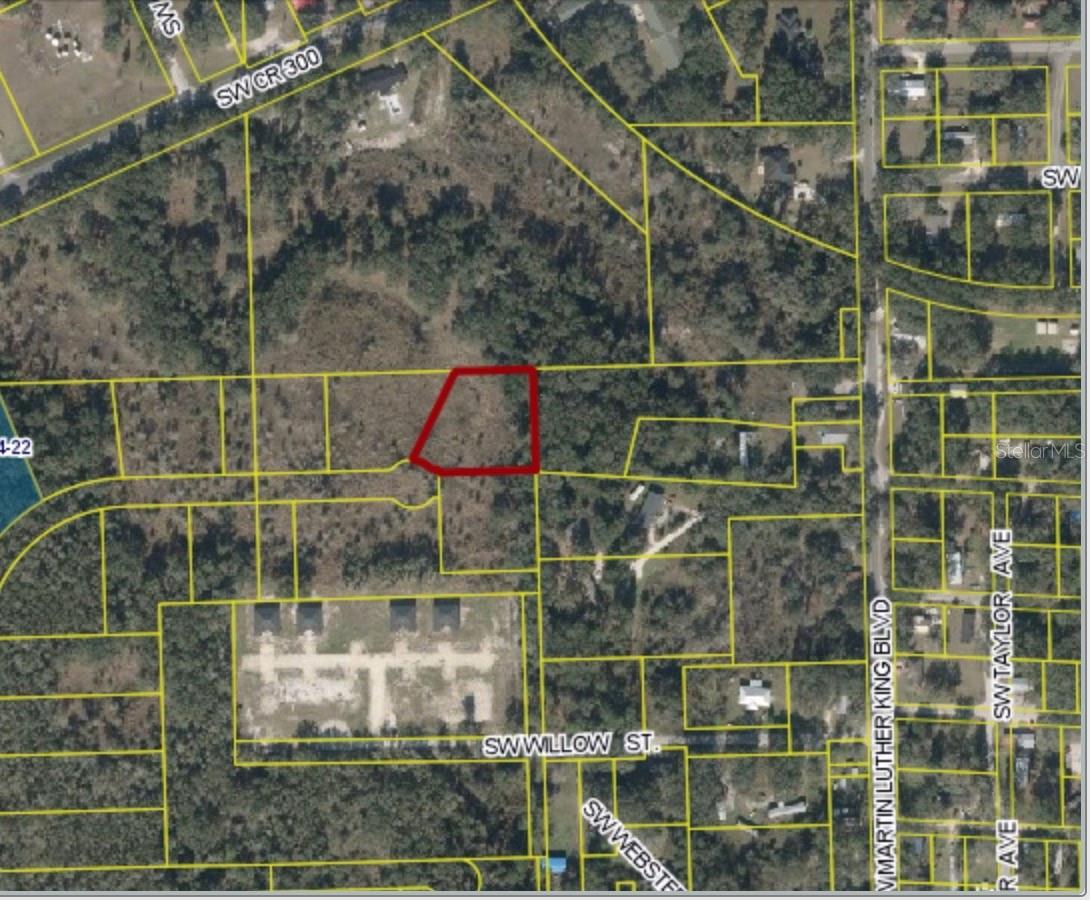
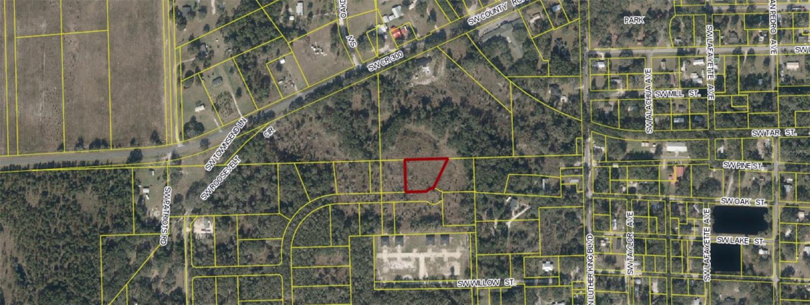
  • MLS#: OM704306 ( Land )
  • Street Address: 00 Roosevelt
  • Viewed: 7
  • Price: $24,000
  • Price sqft: $0
  • Waterfront: No
  • Year Built: Not Available
  • Bldg sqft: 0
  • Days On Market: 12
  • Additional Information
  • Geolocation: 30.0509 / -83.1871
  • County: LAFAYETTE
  • City: MAYO
  • Zipcode: 32066
  • Provided by: REAL BROKER, LLC
  • Contact: Melissa Martinez
  • 855-450-0442
  • mfrmls
  • DMCA Notice
  • Description
    Nestled at the end of a quiet cul de sac, this expansive 1 acre property offers the perfect blend of tranquility and opportunity. Whether you're dreaming of building your forever home or creating a private retreat, this picturesque lot provides the ideal canvas. Surrounded by lush greenery and enjoying minimal traffic, the location is perfect for families, nature enthusiasts, or anyone seeking a serene escape. Imagine waking up to the sounds of birdsong, with plenty of space for gardens, outdoor entertaining, or even a custom pool. Your dream home starts here!
Property Features
Home Owners Association Fee
  1. 0.00
Carport Spaces
  1. 0.00
Close Date
  1. 0000-00-00
Country
  1. US
Covered Spaces
  1. 0.00
Current Use
  1. Residential
Garage Spaces
  1. 0.00
Insurance Expense
  1. 0.00
Legal Description
  1. LEG 0001.00 ACRES COM AT SW COR OF NW1/4 OF SE1/4 14-05-11; TH N.89 06'07 E ALONG S. LINE OF NW1/4 OF SE1/4 OF SAID SECTION 589.42 FT; TH. N.77 46'18 W. 181.03 FT TO POINT OF CURVATURE OF A CURVE CONCAVE TO NE HAVING A CENTRAL ANGLE OF 76 50'58 A RADIUS OF 367.82 FT. A CHORD OF 457.19 FT AND A CHORD BEARING OF N.39 20'49 W; TH. ALONG ARC OF SAID CURVE 493.35 FT; TH. N.0 55'20 W. 566.45 FT; TH. N.41 11'31 E. 64.10 FT; TH. N.89 04'36 E. 519.02 FT; TH N.00 55'20 W. 315 FT; TH N. 89 04'36 E. 1056.88 FT. TO P.O.B.; TH CONT. N.89 04'36 E. 160.26 FT; TH. S.01 00'02 E. 210 FT; TH. S.89 04'36 W. 207.53 FT TO A POINT ON A CUL-DE-SAC CONCAVE TO THE SW HAVING A CENTRAL ANGLE OF 62 00'16 A RADIUS OF 50 FT. A CHORD OF 53 FT AND A CHORD BEARING OF N.58 55'16 W.; TH. ALONG THE ARC OF SAID CUL-DE-SAC 55.85 FT; TH. N.25 53' 06 E. 203.82 FT. TO CLOSE ON P.O.B. OR BK 245 P. 30-31.
Living Area
  1. 0.00
Lot Features
  1. Buildable
Area Major
  1. 32066 - Mayo
Net Operating Income
  1. 0.00
Open Parking Spaces
  1. 0.00
Other Expense
  1. 0.00
Parcel Number
  1. 14-05-11-0000-0000-03205
Pets Allowed
  1. Yes
Possession
  1. Close Of Escrow
Property Type
  1. Land
Sewer
  1. None
Tax Year
  1. 2024
Utilities
  1. Electrical Nearby
  2. Water Nearby
Water Source
  1. None
Zoning Code
  1. R1